
India Maps


| 0 | A | B | C | D | E |
| F | G | H | I | J | K |
| L | M | N | O | P | Q |
| R | S | T | U | V | W |
| X | Y | Z | # | ||
India Maps
There are many different types of India maps that can be found on the web, each with their own unique features and information.
One common type of India map is the political map, which shows the country's states and union territories, as well as their capital cities and major roads. These maps are often used for educational and reference purposes, as they provide a clear and detailed overview of India's administrative divisions.
Another type of India map is the physical map, which illustrates the country's topography and natural features, such as mountains, rivers, lakes, and deserts. These maps are often used by hikers, travellers and environmentalists to understand the geography of India.
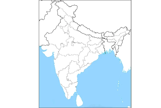
A blank map of India, also known as an outline map, is a map that shows the outline or shape of the country without any additional information or labels. These maps are often used for educational and reference purposes, as they provide a basic visual representation of India's geographical boundaries.
A cities map of India is a detailed map that specifically focuses on the major cities and towns of India. These maps provide a clear and comprehensive view of the urban areas of the country, showing the location of landmarks, important buildings, and other important features within each city.
A states map of India is a detailed map that specifically focuses on the individual states and union territories of India. These maps provide a clear and comprehensive view of the administrative divisions of the country, showing the location of major cities, towns, roads, and other important landmarks within each state.
One common type of India map is the political map, which shows the country's states and union territories, as well as their capital cities and major roads. These maps are often used for educational and reference purposes, as they provide a clear and detailed overview of India's administrative divisions.
Another type of India map is the physical map, which illustrates the country's topography and natural features, such as mountains, rivers, lakes, and deserts. These maps are often used by hikers, travellers and environmentalists to understand the geography of India.
A blank map of India, also known as an outline map, is a map that shows the outline or shape of the country without any additional information or labels. These maps are often used for educational and reference purposes, as they provide a basic visual representation of India's geographical boundaries.
A cities map of India is a detailed map that specifically focuses on the major cities and towns of India. These maps provide a clear and comprehensive view of the urban areas of the country, showing the location of landmarks, important buildings, and other important features within each city.
A states map of India is a detailed map that specifically focuses on the individual states and union territories of India. These maps provide a clear and comprehensive view of the administrative divisions of the country, showing the location of major cities, towns, roads, and other important landmarks within each state.