
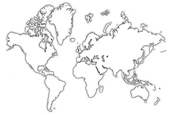
Detailed World Map
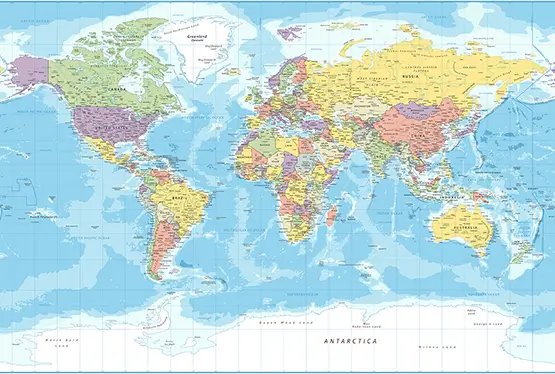
High Resolution Detailed World Map

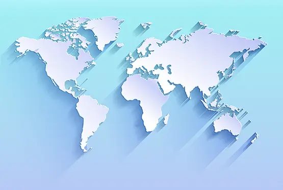
World Maps


GK NXT - Great Knowledge for Genius Kids
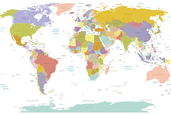
A world map, detailed and rendered in stunning colors, is not just a geographical representation; it is a visual ode to the complexity and diversity of our planet. From the lush green forests of the Amazon to the arid, sun-baked expanses of the Sahara, every shade tells a story. This article explores the artistry, science, and significance behind detailed world maps, demonstrating their role in education, exploration, and conservation.
The modern world map is a culmination of centuries of cartographic evolution, blending artistic creativity with scientific precision. Every element, from the curvature of coastlines to the delineation of political borders, involves meticulous craftsmanship and advanced technology.
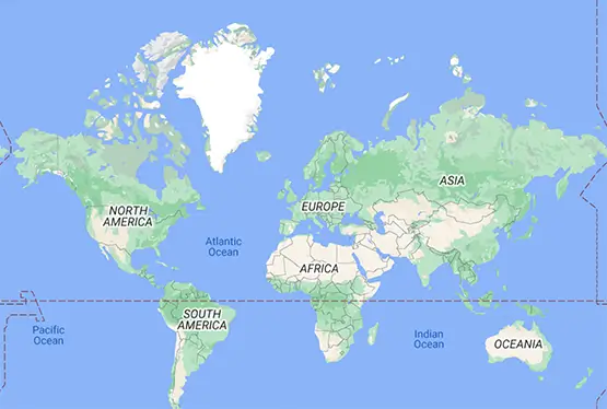
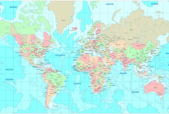
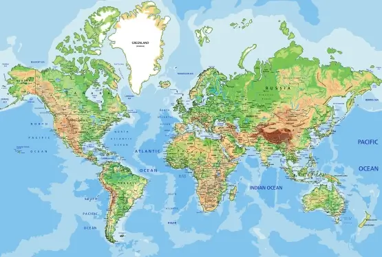
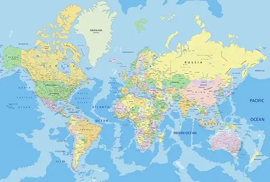
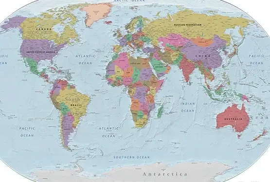
Vibrant colors are employed not merely for aesthetics but as an intuitive tool for understanding. Green represents lowlands and fertile regions, while shades of yellow and brown mark arid zones and elevations. Oceans and seas are painted in varying depths of blue, illustrating their profound gradients. This color-coded language transforms maps into universally understood visual narratives.
World maps are indispensable in classrooms, serving as gateways to global understanding. They help students grasp spatial relationships, identify natural and political boundaries, and comprehend climatic patterns. For instance, tracing the mountain ranges like the Andes or Himalayas reveals their influence on weather systems and human settlements.
Beyond geography, maps intersect with history, politics, and ecology. A detailed map can illustrate the expanse of empires, trade routes, or the spread of ecosystems. Interactive digital maps have further enhanced this educational utility, allowing users to overlay historical, environmental, or economic data onto physical landscapes.
The journey of cartography dates back thousands of years. Ancient civilizations like the Babylonians and Egyptians created rudimentary maps to navigate their worlds. The Age of Exploration brought a renaissance in map-making, with figures like Gerardus Mercator revolutionizing projections to depict the Earth more accurately.
Today, Geographic Information Systems (GIS) and satellite technology enable cartographers to produce maps with unparalleled accuracy and detail. These tools not only map physical features but also track changes such as deforestation, urbanization, and climate shifts, offering vital insights for policymakers and scientists.
Beyond their academic and artistic value, world maps have practical applications across diverse fields. Urban planners use them to design sustainable cities, while environmentalists rely on them to monitor endangered habitats. Travelers and adventurers depend on maps for navigation and exploration, while disaster management teams use them to identify vulnerable regions.
For example, detailed maps of coastal regions have been crucial in planning defenses against rising sea levels. Similarly, maps highlighting biodiversity hotspots help direct conservation efforts to areas that need them the most.
The future of cartography lies in interactivity and integration. Virtual Reality (VR) and Augmented Reality (AR) are transforming static maps into immersive experiences. Users can "walk" through 3D landscapes or overlay real-time data onto their surroundings.
Sustainable mapping is another emerging trend. By visualizing environmental changes over time, maps are becoming tools for advocacy and action, urging humanity to address challenges like deforestation, climate change, and urban sprawl.
A detailed world map in stunning colors is more than a tool—it is a bridge connecting people to the planet. It inspires curiosity, fosters understanding, and underscores the intricate beauty of Earth's landscapes. As technology advances, these maps will continue to evolve, offering ever-deeper insights into the world we share.
FAQ
Q: What is the significance of a world map in stunning colors?
A: A world map in stunning colors not only highlights geographical features like mountains, rivers, and deserts but also serves as a tool for education, navigation, and conservation. The vivid colors provide clarity and visual appeal, making it easy to understand the Earth's landscapes.
Q: How are colors used to represent features on a world map?
A: Colors on a world map are used intuitively: green for lowlands, yellow and brown for arid regions and elevations, blue for water bodies, and white for snow and ice-covered areas. This coding helps users quickly identify and understand different terrains.
Q: How have world maps evolved over time?
A: World maps have evolved from ancient clay tablets to modern digital maps. The introduction of satellite technology, GIS, and interactive tools like VR and AR has revolutionized cartography, allowing for greater accuracy and engagement.
Q: What are the practical applications of detailed world maps?
A: Detailed world maps are used in urban planning, disaster management, environmental conservation, navigation, and education. They help monitor biodiversity, plan infrastructure, and identify vulnerable regions for proactive measures.
Q: How can interactive maps enhance the user experience?
A: Interactive maps, powered by VR and AR technologies, allow users to explore 3D landscapes, overlay real-time data, and visualize environmental changes dynamically. This makes them more engaging and informative than traditional static maps.
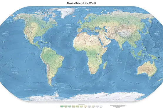
Ultra High Resolution Detailed World Map

