
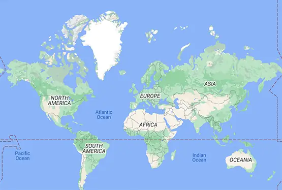
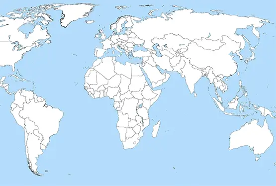
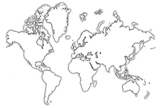
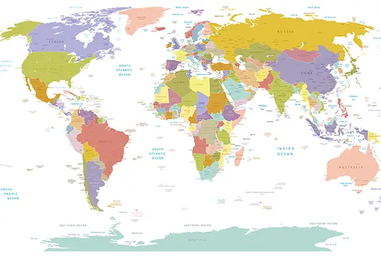
World Map Outline
High Resolution World Map Outline

World Map Outline (png)

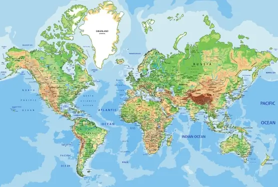
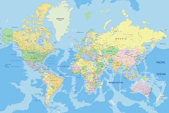
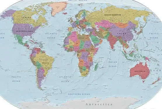
World Maps


GK NXT - Great Knowledge for Genius Kids
The world map outline is one of the most iconic and versatile cartographic tools available today. Stripped of extraneous details, it reveals the basic contours of continents, oceans, and political boundaries. This simplicity allows it to serve a range of purposes, from educational exercises to complex geographical analyses. In this article, we explore the significance, history, uses, and potential of the world map outline in an increasingly interconnected world.
The concept of a world map outline can be traced back to early civilizations. Ancient cartographers in Mesopotamia and Greece used rudimentary outlines to depict the known world. These early maps were often symbolic, emphasizing religious or cultural significance over geographical accuracy.
By the Renaissance, advancements in exploration and cartography led to more accurate outlines of the Earth’s landmasses. Gerardus Mercator’s 1569 map revolutionized navigation by introducing a projection that preserved straight-line courses, making it easier to plot journeys across oceans.
World map outlines are invaluable in education, offering students a hands-on way to learn geography. By filling in labels, drawing borders, or coloring regions, students engage directly with the map, reinforcing their understanding of spatial relationships.
For example, students can use outlines to trace trade routes like the Silk Road or maritime paths like the Atlantic Triangle Trade. These exercises not only build geographical knowledge but also connect students to historical and cultural narratives.
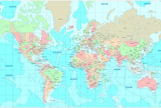
In today’s data-driven world, map outlines play a critical role in visualizing information. They are often used in Geographic Information Systems (GIS) to overlay data such as population density, climate patterns, or political affiliations. Businesses use them for market analysis, while environmentalists rely on them to monitor changes in ecosystems.
One notable example is the use of world map outlines in tracking global deforestation. By overlaying satellite imagery, scientists can highlight areas of concern, raising awareness and guiding conservation efforts.
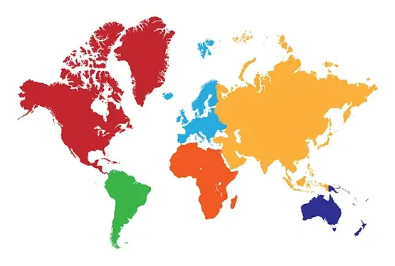
Beyond practical applications, world map outlines inspire creativity. Artists often use them as a base for projects ranging from intricate illustrations to abstract designs. Travelers use them to mark the countries they’ve visited, turning maps into personal mementos.
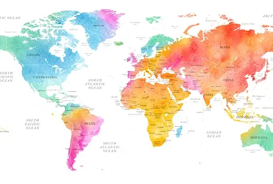
In digital spaces, blank map outlines have become popular templates for infographics, offering a visually engaging way to present data. For instance, social media platforms frequently feature map-based visuals to illustrate global trends in health, education, or politics.
The evolution of technology has greatly enhanced the utility of world map outlines. Digital tools now allow users to customize maps with layers of data, interactive elements, and real-time updates. GIS software and applications like Google Earth enable users to manipulate map outlines to suit specific needs.
These advancements have made map outlines indispensable in fields like urban planning, disaster management, and climate research. For example, during natural disasters, outline maps help visualize affected regions and coordinate relief efforts more effectively.
The world map outline is far more than a minimalist depiction of our planet. It is a tool for education, analysis, and creativity that continues to evolve with advancements in technology. Whether used to teach geography, visualize data, or inspire art, the humble map outline remains a cornerstone of our understanding of the world and our place within it.
FAQ
Q: What is a world map outline?
A: A world map outline is a simplified depiction of the Earth's continents, oceans, and political borders without additional details like names or features. It serves as a versatile tool for education, art, and data visualization.
Q: How can a world map outline be used in education?
A: It helps students learn geography by filling in country names, drawing borders, and identifying landmarks. It also aids in teaching history and cultural studies through exercises like mapping trade routes or historical events.
Q: What are some modern applications of world map outlines?
A: They are used in GIS to overlay data like climate patterns or population density. Businesses rely on them for market analysis, while conservationists use them to track deforestation and other environmental issues.
Q: How do technological advancements enhance the utility of map outlines?
A: Digital tools like GIS and apps such as Google Earth allow customization of map outlines with data layers, interactivity, and real-time updates, making them indispensable in various fields, including disaster management and urban planning.
Q: What are the creative uses of world map outlines?
A: Artists use them for illustrations and abstract designs. Travelers mark visited countries, turning maps into personalized mementos. They are also popular in infographics to visually represent data trends.
Ultra High Resolution World Map Outline
