
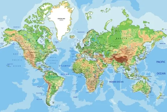
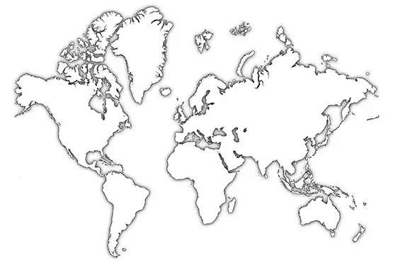
World Map with Continents
Free High Resolution World Continents Map

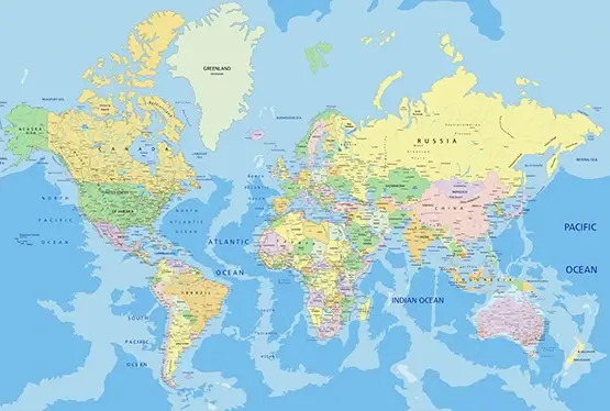
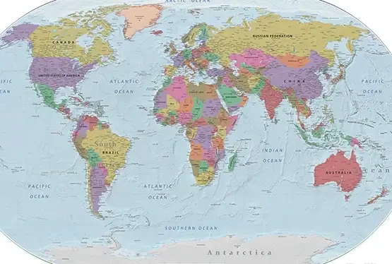
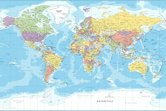
World Maps


GK NXT - Great Knowledge for Genius Kids
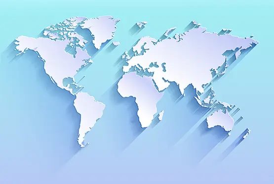
Free World Map with Continents
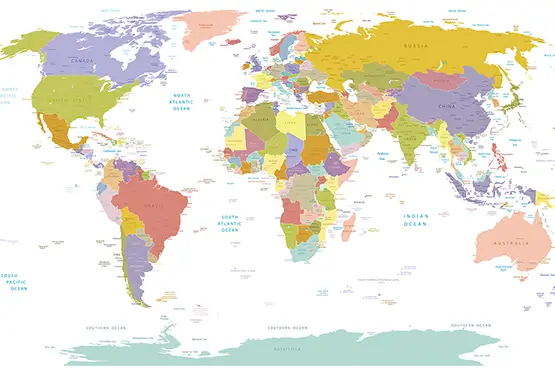
The Free World Map is a testament to humanity's insatiable curiosity to explore, document, and understand the planet we call home. Divided into seven continents, it serves as a geographic framework for understanding Earth's diverse landscapes, cultures, ecosystems, and historical narratives. This article delves into the rich complexity of the Free World Map, uncovering the significance of each continent, the intricacies of mapping technologies, and the historical evolution of cartography.
Historical Evolution of Free World Maps
From ancient Babylonian clay tablets to today’s high-resolution digital maps, cartography has evolved remarkably over millennia. Early maps, such as the 6th-century BCE Babylonian Map of the World, reflected a simplistic view of Earth, often centered on the mapmaker's region.
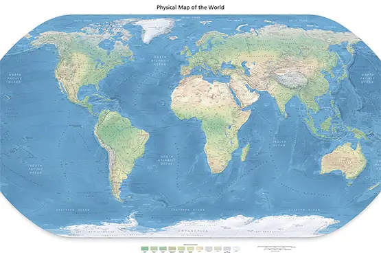
The Age of Exploration (15th–17th centuries) revolutionized mapping, with figures like Gerardus Mercator introducing new projections to accurately depict the Earth’s curved surface on flat paper. The Mercator projection, while invaluable for navigation, distorted landmasses near the poles—an issue addressed by modern projections like the Winkel Tripel and Robinson projections.
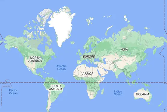
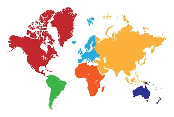
Continents: A Global Overview
Asia
Asia, the largest continent, spans 44.58 million square kilometers and is home to 4.7 billion people, making it the most populous continent. It encompasses diverse terrains, from the Himalayan peaks to the Gobi Desert, and hosts ancient civilizations like those in Mesopotamia and the Indus Valley.
Africa
Africa, known as the cradle of humanity, covers 30.37 million square kilometers and includes 54 countries. Its iconic landscapes—from the Sahara Desert to the Congo Rainforest—are matched by its cultural richness, including over 2,000 languages spoken.
North America
North America spans 24.71 million square kilometers and includes three major nations: the United States, Canada, and Mexico. Known for its varied ecosystems, it boasts natural wonders like the Grand Canyon and Niagara Falls, alongside cultural hubs like New York City and Mexico City.
South America
South America, stretching across 17.84 million square kilometers, is home to the Amazon Rainforest and the Andes Mountains. Its rich cultural tapestry includes ancient Inca ruins like Machu Picchu and vibrant traditions like Brazil’s Carnival.
Antarctica
Antarctica, the southernmost continent, spans 14 million square kilometers and remains largely uninhabited due to its extreme cold. Governed by the Antarctic Treaty, it is a hub for scientific research, particularly on climate change and glaciology.
Europe
Europe, covering 10.18 million square kilometers, is a continent steeped in history, from the Renaissance to the Industrial Revolution. Its cultural diversity, economic powerhouses, and architectural landmarks—like the Eiffel Tower and the Colosseum—make it globally significant.
Australia
Australia, including Oceania, covers 8.56 million square kilometers. Known for its unique wildlife like kangaroos and koalas, it is also home to the Great Barrier Reef and vibrant indigenous cultures.
The Significance of Free World Maps
Free World Maps serve as tools for education, navigation, and global awareness. They help students understand geopolitical boundaries, historians analyze trade routes, and environmentalists track climate patterns. By providing a visual representation of Earth's complexity, Free World Maps foster a sense of global interconnectedness.
Modern Mapping Technologies
Innovations like GIS, satellite imagery, and AI-driven cartography have revolutionized how we create and use maps. Platforms like Google Earth provide high-resolution views of remote locations, while applications like ArcGIS allow for detailed spatial analysis. These technologies are essential for urban planning, disaster response, and environmental conservation.
Conclusion
The Free World Map, with its representation of continents, oceans, and geopolitical boundaries, is more than just a geographical tool. It is a lens through which we view history, culture, and the environment. As technology advances, our ability to explore and understand this map deepens, offering endless opportunities to appreciate the beauty and complexity of our planet.
FAQ
What is the purpose of a Free World Map?
A Free World Map provides a visual representation of Earth's continents, oceans, and geopolitical boundaries. It serves as a tool for education, navigation, and understanding global geography and history.
How many continents are there?
There are seven continents: Asia, Africa, North America, South America, Antarctica, Europe, and Australia.
Why do maps use different projections?
Maps use different projections to address the challenge of depicting Earth's curved surface on a flat medium. Some projections, like Mercator, are ideal for navigation, while others, like Robinson, minimize distortion for a more accurate representation.
What are modern mapping technologies?
Modern mapping technologies include GIS (Geographic Information Systems), satellite imagery, and AI-driven tools. These innovations allow for detailed spatial analysis, real-time mapping, and high-resolution visualizations.
What is the significance of Antarctica on the Free World Map?
Antarctica, while largely uninhabited, is significant for scientific research. It plays a critical role in understanding climate change, glaciology, and global environmental patterns.
Ultra High Resolution World Continents Map


